Objective
To analyze the ship traffic and energy use in the Nordic waters. The AIS analysis will assess potential demand of the various zero-carbon fuels, linked to ships and routes, and identify relevant green energy hubs and green shipping corridors.
Approach
All voyages in the Nordic region – both intra-Nordic and those going to/from other regions – are analyzed. Based on energy use and ship characteristics, we analyze the applicability of potential zero-carbon fuels (potential demand) on the fleet, evaluate a geographical distribution of bunkering hubs and identify relevant green shipping corridors.
Delivery
Potential demand of different fuels, potential fuel volume at ports/ geographical locations and relevant green corridors (Task report).
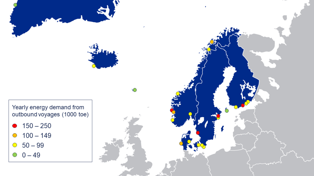
Potential Nordic Energy Nodes
Data on the most important potential energy nodes in the Nordic region based on yearly energy demand from outbound voyages is extracted from the task report and summarized in the image below.
Key facts
Task leader: DNV (Nikolai Rivedal)
Contributors: IVL, Menon, Litehauz, MAN ES
Start date: 2022 Q1
End date: 2022 Q3